The Beginning of a Town: From Chilletecaux to Butler to Kennett
Kennett was an American Indian village long before the county was settled. Just as the Native Americans of this region thought it a desirable location, so did the early settlers. They relocated here and built small log cabins near the town's present site. Eventually, the pioneers made it official by giving the settlement the name, Chilletecaux, after a Delaware (Lenape) tribal chief who was living here at the time.
In 1845, Dunklin County was officially organized, and Chilletecaux was chosen as the county seat. Later, the town's name was changed to Butler. Residents thought the name, Chilletecaux, too long and hard to pronounce. The name, Butler, was eventually changed, as well, because the town's mail was constantly getting mixed up with mail intended for Butler County. In 1851, the community was finally renamed "Kennett," in honor of St. Louis Mayor, L. M. Kennett.
From Trappers to Timbermen to Township
Early settlers, hunters and trappers found the flat, alluvial plain in this area abundant with all types of timber: Tupelo gum, bald cypress, sycamore, oak, elm, hickory, ash and cottonwood. Eventually, they were followed by woodsmen intent on harvesting these forests.
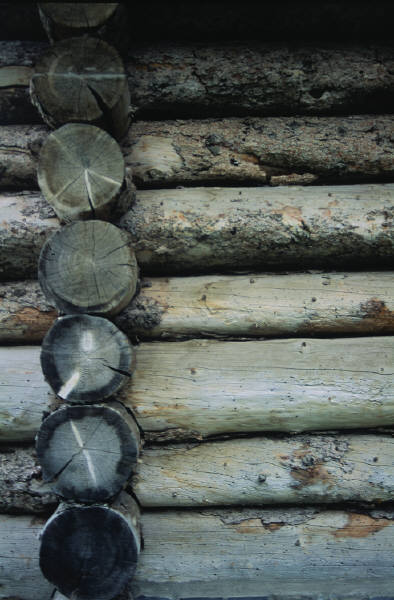
As the town developed into a noted cotton, soybean and livestock farming area, it also grew as a trade and legal center. The first Circuit Court met in 1846, in a 10 ft. x 12 ft. round-pole hut, scarcely high enough for judge and jury to stand in. Jurors A. D. Bridges and E. Holtzhouser helped lay the puncheon-style timber slab floor, smooth on one side, rough on the other. One of the lawyers, H. H. Bedford, lined the wall with coarse cotton panels that protected court documents from flying around the room, carried on winds whistling through the gaps in the pole walls. Crude wooden slabs with peg legs provided the only seating, except for a few chairs borrowed from generous residents. The building also served as the town's first school and church. By 1847, a 40 ft. square courthouse, standing one-and-a-half stories high and made from hewn gum logs, replaced the original pole hut.
The Independent State of Dunklin
In 1862, during the Civil War, Dunklin County adopted a resolution to secede from the Union. The county became known as the "Independent State of Dunklin." Union troops briefly occupied Kennett in1863, and guerrilla raiders constantly roamed the area.
Kennett had been steadily growing, with strong prospects for the future, when the war broke out. When the war ended, however, the town was a shadow of its former self, as was much of the rest of the country. The courthouse, as well as dozens of other buildings, lay in piles of burned ashes. Businesses were destroyed, operations were suspended. In short, daily life in the town came to stop. Kennett had to be almost entirely rebuilt.
Economic recovery began with the arrival in town of the Little River Valley/Arkansas (Cotton Belt) Railroad line in 1892. By 1893, Kennett boasted newly-built brick shops on the south side of the downtown courthouse square, as well as four attractive new churches, and a $9,000 public school building, with over 400 students enrolled.
From Swampland to Farmland
Also in 1893, effective land reclamation began when the state organized county drainage districts and levees on the St. Francis River. Bottomland forests were cleared, and a massive grid of north-south canals were carved from the swamps, in order to drain them. Today, the drainage of 300,000 of Dunklin County's 347,524 total acreage makes our Little River Drainage District the largest drainage system in the nation.
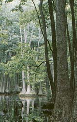
The Little River Drainage District's nearly 1,000 miles of canals and more than 300 miles of levees turned southeast Missouri swamps into fertile farms of soybeans, wheat, corn, rice, and cotton. The conversion was almost total. Portions of virgin swamps and bottomland forests were preserved in the county and can still be seen today. The Ben Cash Memorial State Wildlife Area just west of Kennett is a prime example. Others include the Hornersville Swamp State Wildlife Area and Warbler Woods State Natural Area, as well as Cochran's Opening in Cardwell, Taylor's Slough and Kinamore Slough near New Madrid. These remaining cypress-tupelo swamps, open marshes, flooded timberland and flooded rice fields all add to the ability to attract waterfowl. In fact, they have turned the region into one of the nation's four major flyways during waterfowl migration seasons.
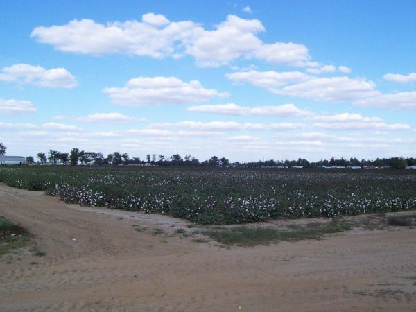
The rich soil in Dunklin County makes it the state's top cotton producer, and ranks it 10th nationally in the number of cotton bales harvested each year. Dunklin County also produces more watermelons and cantaloupes than any other county in the state.
Dunklin County Facts
Dunklin County was officially organized on February 14, 1845, from that portion of Stoddard County that lies south of the parallel, 36 30." Then, in 1853, a strip measuring nine miles wide was added to this territory on the north. The county was named in honor of Daniel Dunklin, who served as the Governor of Missouri from 1832 to 1836.
The county, measuring nearly 50 miles from northern to southern border, covers 540 square miles. It resembles the shape of the capital letter "R." It measures 11 miles wide at the northern border, five miles near the middle, and 22 miles wide at the southern end. |